Description
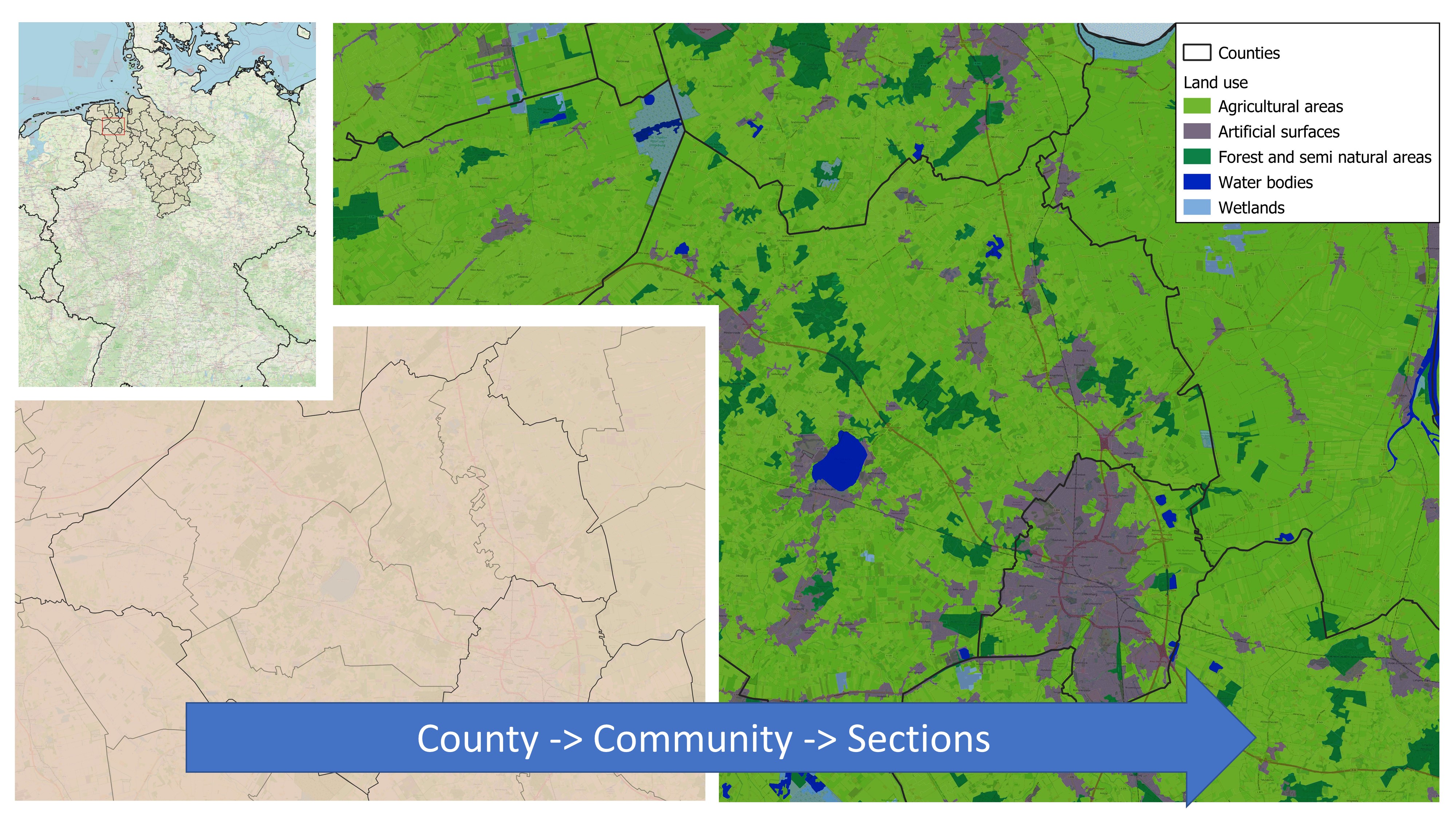
Systematic visualisation and merging of open-source data (water demand and water sources). Identification of water sources by locations.
The Regional Demand-Supply Matching Tool is a GIS tool for visualising and processing open source information on natural water availability and sectoral consumption. The information can be used to identify i) possible consumption focal points and areas of water scarcity, ii) alternative water resources or areas with available water sources, and iii) water transfer from one region to another. Based on the analysis, the impact of alternative water availability scenarios on water demand can be presented.
Target audience
Owner of the product
Sign in to access this information.Actors, their roles and interactions
Water utilities: indicate the need of data management.
Unique selling points
- Automatic identification of suitable (alternative) water sources.
- Visualization of hotspots in water demand and scenarios of water saving.
Technical requirements
QGIS environment necessary.
Publications
Schwesig et al. (2023): Digitale Lösungen für eine wasserbewusste Gesellschaft, Energie|Wasser-Praxis, 6+7/2023, pp. 54-59. https://energie-wasser-praxis.de/wp-content/uploads/2023/06/2023_06_06_FB-Schwesig_0607_2023.pdf
Technology applied by the product
Water recovery technologies for water reuse
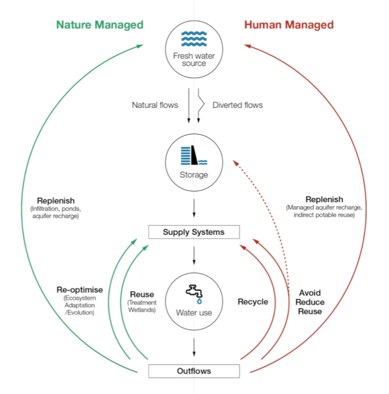
The opportunity with circular economy for water is to better align the human water cycle with the natural water cycle t…